

.png)
.png)


3D Heritage Conservation -
Photogrammetry & 3D Laser Scanning.
Why is 3D Scanning Heritage Conservation Important?
The 3D scanning of Heritage conservation projects is important for the recording of 3D data to future proof the need for engineers, and possible damage or destruction that may occur with buildings, monuments and other objects that may need to be recorded digitally.
How we digitally document heritage projects to ensure future proofing for engineering projects and damage
Using a combination of 3D digital recording techniques, involving 3D Laser Scanners with accuracy upto 2mm Accuracy for engineers. And using photogrammetry to create High Quality Scaled Inspection Models.
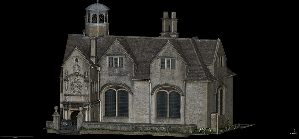
By using the latest equipment which records millions of 3D data points, and combining this with high resolution camera data captured from both camera's and drones when applicable. We can produce high resolution 3D textured models and 3D pointclouds to suit the projects needs.

Deliverables
Our deliverables include 3D pointclouds, 3D textured models, 2D representations that can be loaded into AutoCAD or 2D High resolution ortho-images. We can also create plans, sections and elevations which are all accurate to measure from.
We can also geo-reference the 3D conservation data to a topographic survey for accurate position and elevation location.
Photogrammetry
Using both high-resolution camera equipment and drones we can create very high quality inspection models of important heritage sites and items.
Geo-located models
Using Control Points in conjunction with our GPS & surveying systems enables correctly geo-referenced projects for streamlining further use of the captured data. Our data is scaled accurately and to the correct real world space.
High Quality 3D Interactive Models
Our 3D Inspection models can be viewed online through any internet browser on any device. No need for powerful PCs to view the data. Data will be kept private and accessible as per client requests.
PHOTOGRAMMETRY INSPECTION MODELS


3D Point Cloud Capture
Highly accurate point cloud capture combining both our UAV point cloud technology with our Trimble TX6 Laser scanner for upto 2mm point precision.
Geo-located Point Clouds
Using Ground Control Points in conjunction with our Trimble R10 GPS system enables correctly geo-referenced projects for streamlining further use of the captured Point Cloud.
3D Meshes
Using the drone technology you can create geo-referenced 3D meshes which can let you investigate areas by navigating around the scanned building, don't be restrained by the singular angles of photographs or videos.
BIM Modelling
BIM or Building Information Modelling is a process for creating and managing information on a project across the project lifecycle.
3D LASER SCANNING
Deliverables: High Quality 3D Point Data > CAD Drawn Elevations > Sections & Floor Plans